Two powerful storm cells are being closely watched over Oklahoma this evening, and both are showing all the signs of becoming increasingly dangerous. Meteorologists are tracking strong rotation within each storm alongside a significant hail threat — anyone in or near the path of these cells needs to take immediate action.
Where Are the Storms Right Now
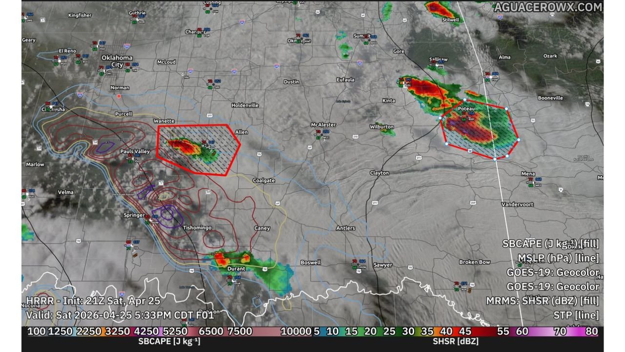
Two distinct storm cells have been flagged as capable of producing very large hail and tornadoes across Oklahoma this evening:
- Western Oklahoma: A dangerous cell is developing near Pauls Valley and Allen, south of Oklahoma City, showing strong rotation and actively being watched for tornado development
- Eastern Oklahoma: A second equally dangerous cell is positioned near Poteau in far eastern Oklahoma, also displaying tornadic characteristics with an intense hail core at its center
Both storms are showing signs of strengthening rather than weakening, meaning the threat is growing, not passing.
What Makes These Storms So Dangerous
The atmospheric setup over Oklahoma this evening is providing everything these storms need to become more powerful:
- Extreme instability: The atmosphere over the region is loaded with energy, giving these storm cells the fuel they need to rapidly intensify
- Very large hail: Radar returns inside both storm cores indicate the presence of extremely large hail — capable of shattering windshields and causing serious property damage
- Tornado threat: Rotation signatures within both cells are increasing, with conditions highly favorable for significant tornado production in the coming hour
If You Are Near These Storms
- Seek sturdy shelter immediately — do not wait for a tornado warning to be issued
- Move to the lowest floor of a solid structure, away from all windows
- Do not attempt to drive through or around these storm cells
- Keep weather alerts active on your phone and monitor local updates in real time
- If you are near Pauls Valley, Allen, or Poteau — treat this as an imminent threat right now
Conditions are evolving rapidly this evening. The situation on the ground can change within minutes. Stay weather aware and do not let your guard down until these storms have fully moved out of your area.
For more severe weather news and analysis, visit readcultured.com — your source for news that matters.
Published for informational purposes only. Storm positions and intensity are subject to change. Always follow official guidance from the National Weather Service and local emergency management authorities.
Leave a Reply